OPENINGS AND CONSTRUCTION WORK
🚴♀️ Trail Opening
The P’tit Train du Nord trail is open between Bois-des-Filion (km 32.5) and Labelle (km 112). Beginning May 16, the section from Labelle (km 112) to Mont-Laurier (km 201) will also be open.
⚠️ Caution: During the spring season, the MRCs are carrying out various maintenance and construction projects (see details below). Some sections may still contain gravel, sand buildup or ruts on stone dust surfaces. Please adjust your speed according to trail conditions.
The P’tit Train du Nord is a family-friendly multi-use trail. Please respect the code of ethics and consult trail conditions before your trip:
https://ptittraindunord.com/en/code-of-ethics/
https://ptittraindunord.com/en/trail-conditions/
Courtesy, smiles and kindness are always appreciated 🙂
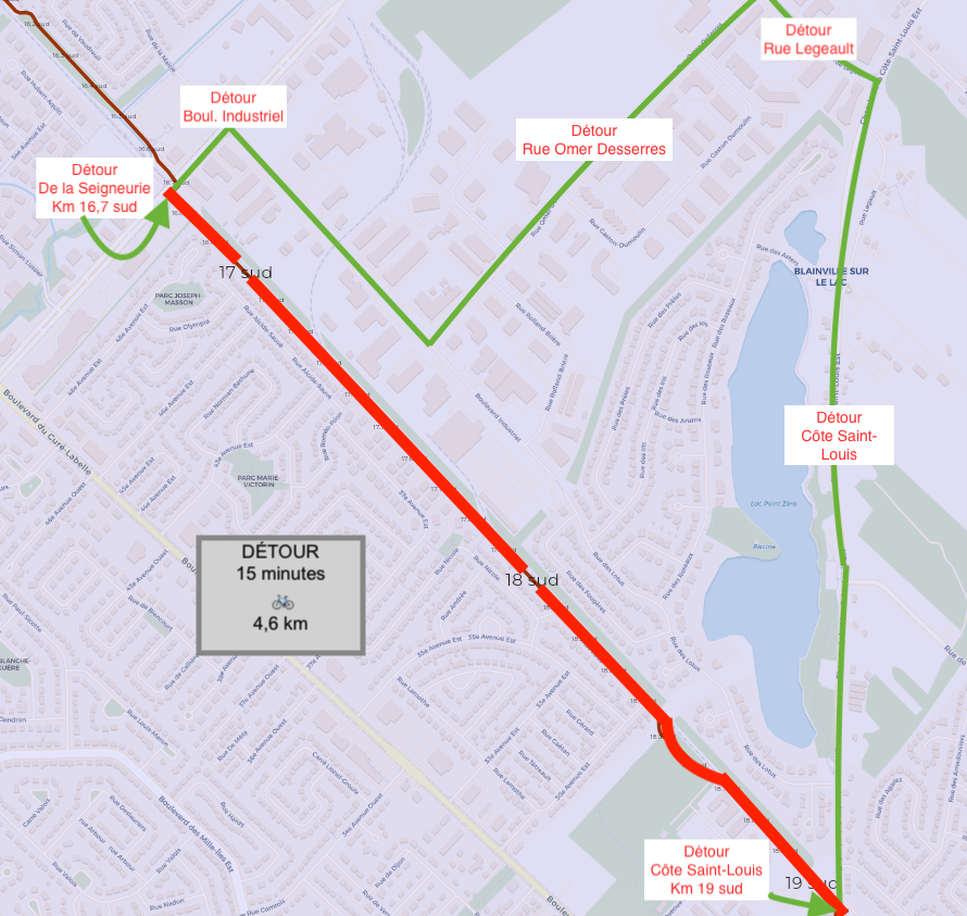
🚧 Construction – Blainville Sector – DETOUR
The trail will be closed from May 11 to June 12 between Côte Saint-Louis (south km 19) and boulevard de la Seigneurie (south km 16.7).
Please refer to the BLAINVILLE detour map below.
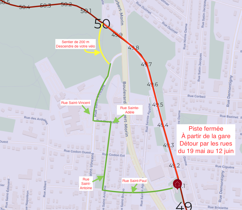
🚧 Construction – Saint-Agathe Sector – DETOUR
From May 19 to June 12, the bike path will be closed between the train station at km 49.1 and km 50 to allow work to be carried out under the viaduct.
➡️ A marked and secure detour is available via the following streets:
• Sainte-Adèle
• Saint-Vincent
• Saint-Antoine
• Saint-Paul
📍 A 200 m path will also allow cyclists to walk their bikes to reconnect with the north section of the trail.
Thank you for your cooperation and caution near the construction zone.
Please refer to the SAINTE-AGATHE detour map below.
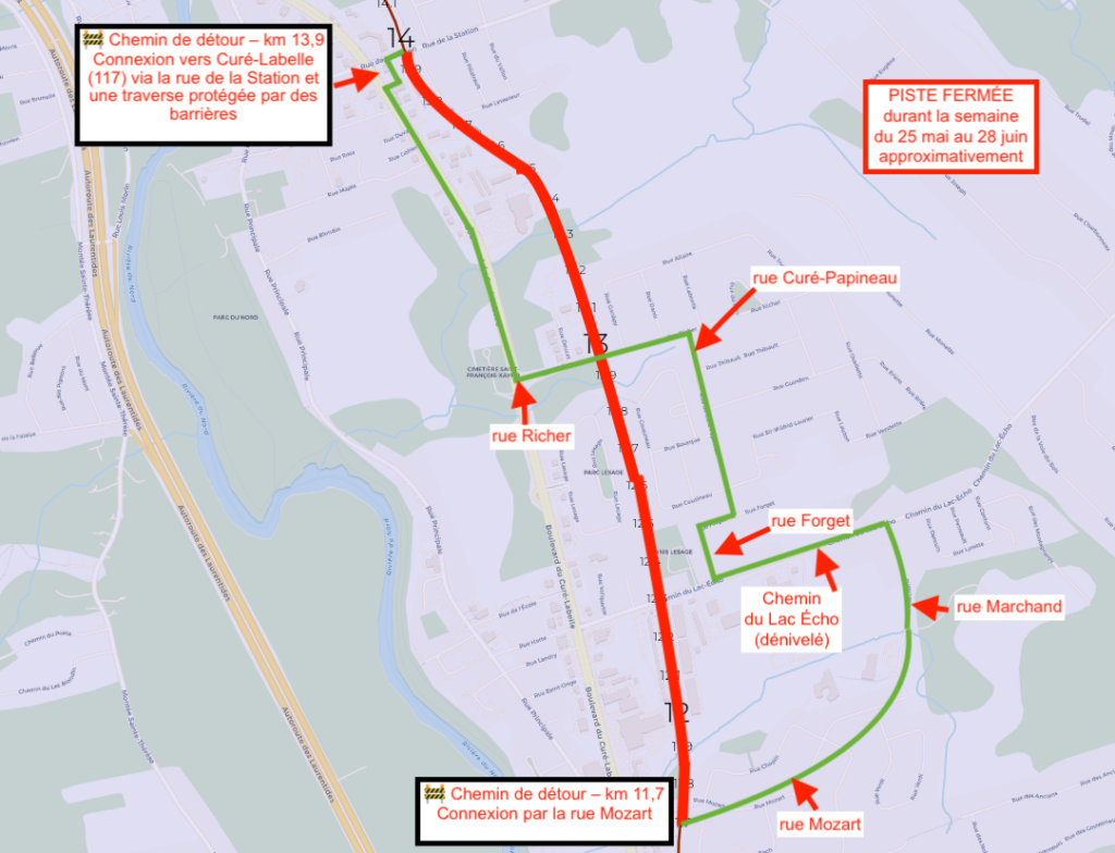
🚧 CONSTRUCTION | Kilometres 11.7 to 14 — Town of Prévost
(between Mozart Street and de la Station Street)
As the MRC is responsible for the P’tit Train du Nord on its territory, roadbed and drainage rehabilitation work will be carried out in this sector to ensure user safety and preserve the trail infrastructure.
📅 Work begins: May 25, 2026
⏳ Expected duration: approximately eight weeks
Work will take place Monday to Friday, from 7 a.m. to 6 p.m.
The trail will remain open on weekends unless otherwise indicated. Please note that machinery may be present and some sections may be uneven.
Some direct accesses to the trail will be temporarily closed during the work, including access points to local businesses.
🔗 More information:
www.mrcrdn.qc.ca/actualites/travaux-ptdn-phase1